Walk of the month: Island Gardens and Mudchute
A sense of space on the waterfront
 23 August 2010
This month Graham Barker explores the south-eastern tip of the Isle of Dogs, and discovers impressive riverside views, a Victorian railway viaduct and friendly farm animals.
There’s a great sense of open space during this month’s walk, with sweeping views – over the Thames to Greenwich, beyond the rolling fields of Mudchute Farm to Canary Wharf, and across Millwall Park to a Victorian railway viaduct.
We start at Island Gardens DLR station, close by the tip of the Isle of Dogs peninsula.
On leaving the station – with views across Millwall Park to the left – follow the paved path straight ahead into Island Gardens (1). It’s hard to imagine this green pocket was once a scrap metal dump.
The Royal Naval Hospital, keen to enhance the view from Greenwich, acquired it in 1895 and laid it out as a small park, sandwiched between shipbuilders and engineering factories.
The glass-domed circular structure is the entrance to the Greenwich Foot Tunnel, which runs for 390 metres under the river
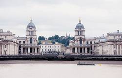
From Island Gardens, there is one of London’s finest views. The centrepiece is Sir Christopher Wren’s Royal Naval Hospital and College sitting on the riverside.
And beyond, there’s the Queen’s House and National Maritime Museum. Up on the hill, look out for the Royal Observatory, home to Greenwich Mean Time.
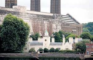
Follow the riverside path. The four towering chimneys of the London Transport power station soon dominate the skyline, with the 1,613 almshouses of Trinity Hospital nestling in its shadow.
At a small inlet, the path brings you to Cubitt Town, named after one-time Lord Mayor of London, William Cubitt.
In 1845 he set up a building yard here, laid out the surrounding streets, and divided up the foreshore for the manufacturing and repair of ships.
At his own expense, he also built Christ Church, towering ahead.
Beyond the inlet, a beautifully sculpted wall plaque (2) from a now-demolished church depicts a kneeling woman.

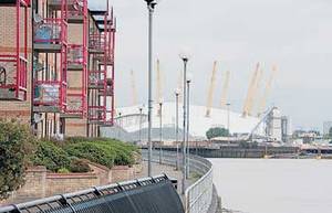
Keep to the Thames, and the 02 Dome emerges into view. It was designed with a diameter of 365 metres, a height of 52 metres, and is supported by 12 prongs, to represent the days, weeks and months in the year – a nod to Greenwich’s role in the history of time-keeping.
Just before Cubitt Wharf – a converted brick warehouse that diverts you briefly from the waterside – pause at the information board on Saundersness (3), so named because it resembled a “nose” or “nez” projecting into the river. Continue through Cubitt Wharf yard, with echoes of the industrial past, to rejoin the Thames.
Facing Sextant Avenue, a pair of cream-coloured obelisks (4) commemorate the 1969 explosion at Dudgeons Wharf. Just before the metal restricting barrier, leave the riverside between the final stepped-gable houses.
Head along Chichester Way, step down through a wooden gateway across Blyth Close. Beside the Pier Tavern on Manchester Road, curve with Pier Street to the entrance of Mudchute Park and Farm.
This 32-acre farm is an East End gem. It sits on land that was earmarked in the 1970s for high-rise flats, but protests from the local community ensured that it was reclaimed as a green space. Now it’s home to pygmy goats, llamas, Tamworth pigs, Irish moiled cows and assorted chickens, ducks and geese.
You soon arrive at the café, shop and toilet complex (5) on your left. Take a break now, or later when the route loops back here. To head on, slope up with the main track, through the metal kissing gate and out into a huge open field (6). It’s remarkable to see sheep and cows grazing with Canary Wharf rising in the distance.
Aim for the tall chimney, but before reaching it turn left along the raised concrete pathway. You’re now walking on the banks of the Mudchute, built for the Millwall Dock Company in the 1870s.
Frederick Duckham, the dock company engineer, designed a system for dredging silt from the docks and piping it here into settling ponds, hence the name Mudchute.
Follow the high-level path, first along one straight stretch and then left along another. On this second stretch, as the allotments end below, go left down the double-sided wooden steps.
The track now snakes between paddocks and enclosures – a chance to meet the animals at close hand – before bringing you back to the deservedly popular Mudchute Café. After exploring, take the wide track behind the café.
At the riding ring, follow the edge of the main block and take a narrow pathway behind the stables. As it curves right, behind the riding ring, slope down to leave the farm through a tall gateway.
You immediately enter Millwall Park, another expanse of green parkland. Curve right, behind the One O’Clock Club, through the adventure playground, to the ‘Woman and Fish’ sculpture – a replica of Frank Dobson’s 1951 original.
The elegant brick viaduct (7) dominates the view across the park. From 1871 to 1926 this carried the Millwall extension of the London and Blackwall Railway, a service known as the ‘Penny Puffer’.

The viaduct was later used by the DLR – until the tracks had to be extended below the Thames to Lewisham – and the northern arches are now used for cricket nets practice.
Walk under the left-hand arches, past a small playground and bowling green. At East Ferry Road, turn right.
The Docklands Settlement (8) to your right – one of several “settlements” established in the East End in the early twentieth century as social and community hubs – offers activities for local residents.
And a short way ahead, cross to Mudchute DLR, the end of the walk.